Looking for a geotechnical engineer in Kerikeri? Gumboots Consulting Engineers is your local geotech Kerikeri specialist. Expert site assessments, soil testing, foundation design, and geotechnical investigations with local knowledge you can rely on since 2018.
Based in Kerikeri, Gumboots Consulting Engineers has been providing specialized geotechnical engineering services throughout the region since 2018. Our intimate knowledge of Kerikeri's unique soil conditions, geological characteristics, and building requirements sets us apart from other engineering firms.
Kerikeri presents specific geotechnical challenges - from the volcanic soils around Waipapa to the varying ground conditions throughout the township. Our team has conducted hundreds of site assessments across Kerikeri, from residential properties in established subdivisions to challenging rural lifestyle blocks. This local experience means we can provide accurate, efficient geotechnical solutions that save you time and money.
Whether you're building your dream home in Kerikeri, developing a subdivision, or need foundation advice for a commercial project, our geotechnical engineers deliver thorough assessments backed by laboratory testing and professional engineering expertise specific to Kerikeri conditions.
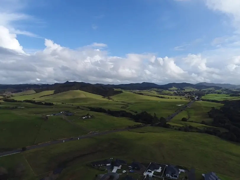
The Kerikeri area sits on the Kerikeri Basalt Formation, a sequence of Pliocene-age volcanic basalt flows that underlie much of the Far North. Weathering of this basalt produces the distinctive red-brown clay soils that are widespread across Kerikeri, Waipapa, and the surrounding district. These volcanic clays have reasonable bearing capacity when dry and well-drained, but their engineering behaviour changes significantly with moisture content. In wet conditions, the clays become plastic and can exhibit swelling-shrinkage behaviour (expansive clay), which places specific requirements on foundation design — particularly for slab-on-ground construction and shallow strip footings.
Profile weathering depths vary across the district. In some areas the basalt rock is close to the surface and test pits encounter fresh to slightly weathered basalt within 1–2 m. In other locations, particularly on gentler slopes and flat ground, deep weathered profiles extend several metres before reaching competent rock. Identifying the depth to rock and the nature of the weathered profile is one of the primary objectives of a geotechnical investigation in Kerikeri.
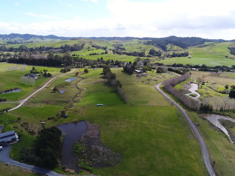
Along the Kerikeri River and Waipapa River corridors, river terrace deposits produce a different soil character — sandy loams and silty alluvial soils with generally lower bearing capacity than the basalt-derived clays. These terrace soils are typically more uniform in profile but may be subject to seasonal groundwater fluctuations in lower terrace positions. Residential development on these terrace areas requires careful assessment of foundation depth, groundwater levels, and potential liquefaction risk in flood-prone positions.
Seasonal shrink-swell behaviour in volcanic red clay soils can cause foundation movement and cracking. Correct foundation depth, stiffened raft design, or deeper footings to competent material are common solutions.
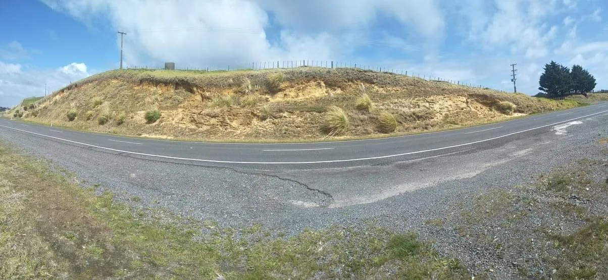
The volcanic basalt landscape creates scarp edges and steep slopes where shallow landslide risk exists, particularly after heavy rainfall. Slope stability assessment is needed for any significant earthworks or building near these features.
Shallow groundwater tables in the wetter months affect foundation design and wastewater system sizing. Site investigations should account for seasonal variation — a dry-season site visit can give a misleading picture of groundwater conditions.
Comprehensive geotechnical engineering solutions tailored to Kerikeri's unique ground conditions
Detailed evaluation of Kerikeri properties to determine suitability for development. We assess soil characteristics, groundwater conditions, and site-specific constraints unique to the Kerikeri area.
Comprehensive subsurface investigations throughout Kerikeri using advanced testing methods to characterize ground conditions and provide engineering parameters for design.
Laboratory and field testing of Kerikeri soils to determine properties essential for engineering design and construction planning specific to local conditions.
Engineering design of foundation systems optimized for Kerikeri's ground conditions and specific building requirements throughout the area.
Contact our Kerikeri-based team for expert geotechnical advice
Based in Kerikeri since 2018, we know the area's soil types, geological features, and building challenges intimately. From volcanic soils to coastal sites, we've worked across every part of Kerikeri.
Being local means we can respond quickly to your needs. Most Kerikeri site assessments can be scheduled within 48 hours, and reports typically delivered within 5 working days.
We have excellent relationships with Far North District Council and understand their requirements thoroughly. Our reports are designed for smooth council approval processes.
Our local presence means lower travel costs and more efficient site visits. We offer competitive pricing for all geotechnical services throughout Kerikeri without compromising on quality.
A selection of recent geotechnical and civil engineering work across Kerikeri, Paihia, and the Far North.
Kerikeri's soils are dominated by red-brown volcanic clays derived from the Kerikeri Basalt Formation. These clays have good bearing capacity when well-drained but become plastic and potentially expansive when saturated, which affects foundation design. Depth to basalt rock varies — some sites encounter fresh rock within 1–2 m, while others have deep weathered clay profiles. Along the Kerikeri and Waipapa river terraces, sandy loam and silty alluvial soils replace the volcanic clays, with shallower bearing strata and a higher likelihood of seasonal groundwater. A site-specific geotechnical investigation is always recommended, as soil conditions can vary significantly even within a short distance in this district.
Far North District Council (FNDC) requires a geotechnical report for most building consent applications outside of flat, well-understood ground. Given Kerikeri's varied basalt terrain — with steep slopes, variable depth to rock, and expansive clay behaviour — FNDC will typically require a site suitability assessment and foundation recommendations from a qualified geotechnical engineer. This report establishes the soil bearing capacity, foundation type, and any site-specific conditions the designer must account for. Without this report, building consent applications on non-standard sites will generally be placed on hold.
For a standard residential site suitability assessment in Kerikeri, we typically schedule the site visit within 2–5 working days of instruction and deliver the written report within 5 working days of the site visit — so a total turnaround of around 7–10 working days in most cases. More complex investigations involving test pit excavation, in-situ testing, or laboratory analysis take longer, usually 2–3 weeks from instruction to report delivery. We work around your consent and construction timelines, so let us know your deadline and we'll advise on what's achievable.
Yes — Gumboots offers integrated engineering across geotechnical, wastewater (TP58), and civil disciplines from a single Kerikeri-based team. For sites that need both a geotechnical report and a TP58 wastewater design (required for on-site sewage systems under FNDC's rules), we can carry out the investigations and soil permeability testing in a single site visit and produce coordinated reports. This avoids duplicate site visits, reduces cost, and ensures your geotechnical report and wastewater design are consistent with each other — which FNDC expects to see in a complete consent application.
Based in Kerikeri, we're ready to help with your geotechnical engineering needs. Contact us today for expert site assessments, soil testing, and foundation design throughout Kerikeri and the wider Far North.
Kerikeri, Northland
Servicing all of Kerikeri