Thames

Geotechnical Engineer Thames

Specialist geotechnical engineering for Thames and the Hauraki Plains from Gumboots Consulting Engineers. Expert site assessments, soil testing, and foundation design for alluvial plains, volcanic hill margins, and Thames's unique historic mine-affected ground. TCDC consent support from our Whangamata office.

Geotechnical Engineering for Thames & Hauraki Plains

Thames sits at the southern gateway to the Coromandel Peninsula, where the rugged volcanic ranges of the Coromandel meet the low-lying Hauraki Plains. This geological transition creates a distinctive range of ground conditions — from soft, compressible alluvial soils on the plains to competent volcanic rock and residual clay on the hill margins — and each zone has specific engineering implications that require local knowledge to navigate correctly.

Geotech site investigation
Site assessment Coromandel
Gumboots Engineers on site

Thames also carries a historic gold and silver mining legacy. The Thames Goldfields, active from the 1860s, left behind a network of mine shafts, adits, and tailings deposits that are a genuine geotechnical hazard for development in parts of the town. Identifying and managing mine-affected ground is a specialist skill, and our team understands how to integrate historic mining records into site assessments for affected properties.

Gumboots provides geotechnical investigations, foundation design, and TCDC-ready reports for residential, commercial, and infrastructure projects across Thames and the Hauraki Plains. Our Whangamata office serves the full Coromandel Peninsula, including Thames as the southern hub.

Ready to Start Your Thames Project?

Get expert geotechnical advice tailored to Thames's complex ground conditions.

Thames Soils & Ground Conditions

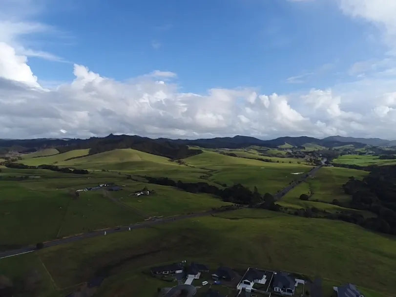
Hauraki Plains — Soft Alluvial Soils

The Hauraki Plains south and west of Thames are underlain by Holocene alluvial deposits — soft silts, peats, and clays laid down in the former Hauraki Gulf embayment. These soils are highly compressible and have very low undrained shear strength in their natural state. Foundations placed directly on soft Hauraki alluvium will settle significantly over time. Engineering approaches for plain-adjacent development typically involve ground improvement (preloading, surcharging, dynamic compaction), deep foundations bypassing the soft layer, or careful selection of lightweight or flexible structure types.

Historic Goldfields — Mine-Affected Ground

The Thames Goldfields produced New Zealand's richest gold deposits and left behind hundreds of mine shafts, adits, drives, and tailings ponds across the hills east of Thames township. Ground investigation in areas with historic mining must include a desktop review of available mine records before physical investigation — an unrecorded shaft can present an unacceptable hazard. Our site assessments for mine-affected areas follow best-practice protocols, including review of NZ Mines Register records and Hauraki District Council and TCDC heritage mapping.

Volcanic Hill Margins

The Coromandel Ranges rising behind Thames consist of andesite, rhyolite, and dacite volcanic rocks of the Coromandel Volcanic Zone, weathering to residual clays and colluvial slope deposits. Hillside and hill-margin sites have generally better bearing capacity than the alluvial plains but may have steep-slope instability risk, variable depth to rock, and high seasonal groundwater in weathered profiles.

Common Geotechnical Issues in Thames

Soft Ground Settlement

Compressible Hauraki Plains alluvium can cause ongoing settlement of structures. Foundation design must account for total and differential settlement, particularly for slab-on-ground and floor-level sensitive structures.

Historic Mine Shafts

Unmapped mine workings beneath Thames hill-margin properties can create ground collapse risk. Desktop mining record review followed by targeted ground investigation is essential before earthworks or building in affected areas.

High Groundwater on Plains

Seasonal groundwater tables are high across the Hauraki Plains margins of Thames. Shallow groundwater affects foundation design, wastewater system sizing, and stormwater infiltration rates.

Geotechnical Services in Thames

Comprehensive geotechnical engineering solutions for Thames and Hauraki Plains ground conditions

Site Suitability Assessments — Thames

Site suitability reports covering Thames's varied ground zones — alluvial plains, volcanic hill margins, and mine-affected areas. TCDC-ready format.

  • Mine record desktop review
  • Soft ground identification
  • Natural hazard assessment
  • Building platform recommendations

Geotechnical Investigations — Thames

Subsurface investigations using test pits, DCP, CPT, and boreholes to characterise alluvial, volcanic, and mine-affected ground profiles across Thames.

  • Test pit excavations
  • DCP and CPT testing
  • Soft ground profiling
  • Groundwater monitoring

Soil Testing — Thames

Laboratory and field testing of Thames soils including compressibility testing of alluvial deposits, bearing capacity assessment, and permeability for TP58 wastewater design.

  • Shear strength testing
  • Compressibility / consolidation
  • Permeability testing for TP58
  • Soil classification

Foundation Design — Thames

Foundation engineering for Thames's challenging ground — soft ground treatment strategies for plain sites, and conventional design for volcanic hill-margin locations.

  • Deep foundation options for soft ground
  • Ground improvement design
  • Settlement analysis
  • Retaining wall design

Thames Geotechnical Engineering — FAQs

Thames sits at the interface of two very different geological environments: the soft, low-bearing Hauraki Plains alluvium to the south and west, and the volcanic hill terrain of the Coromandel Range to the north and east. The plains soils are highly compressible and require specialist soft-ground engineering. Additionally, Thames is unique in the Coromandel for its historic gold and silver mining legacy — mine shafts, adits, and tailings ponds from the 1860s–1950s goldfields period can underlie hill-margin properties, creating ground collapse risk that a standard site investigation would not detect without prior desktop review of mining records. This combination of soft plain soils and mine-affected hill ground makes Thames one of the more technically demanding geotechnical environments on the Coromandel Peninsula.

Before any physical investigation on a Thames property in or near the historic goldfields area, we carry out a desktop review that includes the NZ Mines Register, TCDC heritage mapping, historic survey records, and aerial photography review. Many shafts are recorded; others are not. Where mine workings cannot be excluded, investigation must be designed conservatively — for example, avoiding test pit excavations directly over probable shaft locations, using geophysical methods to help locate voids, and applying appropriate setback distances from identified workings. Our geotechnical reports for mine-affected Thames sites address this hazard explicitly and recommend management measures that satisfy TCDC requirements.

Yes — TCDC requires a geotechnical report for building consent applications on sites with ground conditions that deviate from standard stable ground. Given the prevalence of soft alluvial soils, mine-affected ground, and steep volcanic terrain in Thames, most non-standard sites will require a site suitability assessment and foundation recommendations from a CPEng-qualified geotechnical engineer. TCDC's Thames-Coromandel District Plan identifies significant portions of Thames as having natural hazard risk overlays. Providing a thorough geotechnical report upfront is the most efficient pathway through the TCDC consent process for Thames properties.

Contact Us — Thames Geotechnical Engineering

Gumboots Consulting Engineers serves Thames from our Whangamata office. Contact us for site assessments, soil testing, and council-ready geotechnical reports for Thames and the Hauraki Plains.

Location

Whangamata office, Coromandel

020 4 GUMMYS Email Us